This interview produces a sample design strategy for empty SADA files based on MARSSIM principles.
Availability
This interview is only available for empty SADA files.
Steps
These are the steps that display in the Steps Window when this interview is selected. Click on the links below for more details about the following steps.
4. MARSSIM Parameters
The user must establish site boundaries using Step 2 Set up the site. If desired, the polygon tool may be used to establish one or more survey units within the site. When developing a MARSSIM design, only a surface layer design is permitted. A surface layer design is defined as a single layer design with Z min =0 and Z max = 0. SADA automatically creates a default and uneditable layer called "Surface Layer" that satisfies these requirements or the user may choose to create and use on of their own.
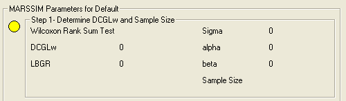
Once the site parameters are established, the user must specify the MARSSIM sample design parameters. Click on MARSSIM parameters to choose the MARSSIM class, choose the statistical test, and select whether the grid sampling will be triangular or square. The MARSSIM class choices are I, II, or III.
Once the MARSSIM parameters are setup as needed, the user must select Step 5. Show The Results to go through the process of determining the number of samples needed.
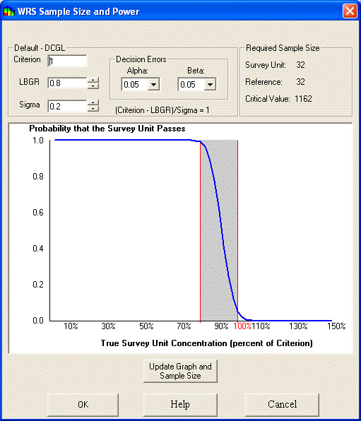
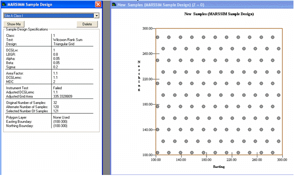
Given a test method, the user then inputs the Derived Concentration Guideline (DCGL), the Lower Bound of the Gray Region (LBGR), the expected standard deviation (Sigma), and the acceptable rates for alpha (false positive) and beta (false negative) decision errors. With these inputs, SADA will show a power curve and the number of samples necessary to characterize the decision.
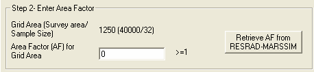
For Class I and II sites, based upon the area of the site and the number of samples to be collected, a grid area can be derived which is the maximum area of a hot spot that can be missed by systematic sampling. Associated with this is an area factor which is a factor used to adjust the DCGLw in order to estimate DCGLemc and the minimum detectable concentration for scanning surveys.
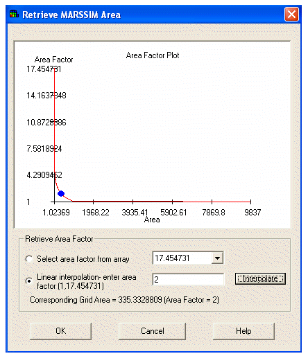
If necessary, the area factor can be retrieved from an excel file that contains adjoining columns for area and area factor. The range of interest must be a range named in Excel as "Marssim". Once the file is successfully imported the Area-Area Factor plot will be displayed.
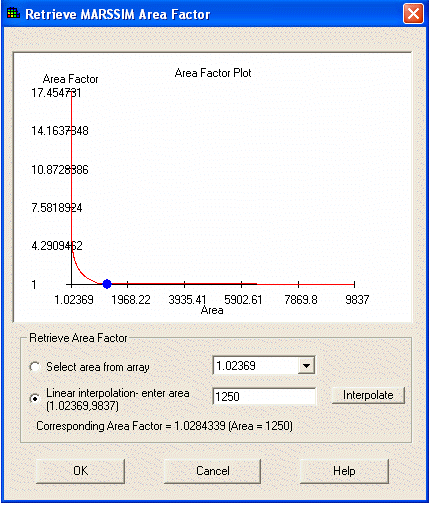
SADA will interpolate the area factor for the area of your site based upon the area-area factor curve for your contaminant.
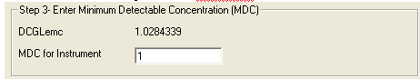
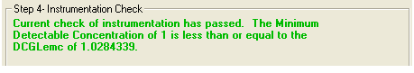
Once the area factor is entered, the DCGLemc can be calculated and the user must enter the Minimum Detectable Concentration (MDC) of the scanning instrument to ensure that the scanning instrument can detect radionuclide concentrations at the DCGLemc. If the MDC is less than or equal to the DCGLemc:
Then the user will get a message that the instrument check has passed and the number of samples that were calculated earlier is sufficient:
However, if the MDC is greater than the DCGLemc:
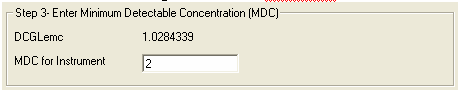
The user will get a message stating that the instrument check has failed and that a revised grid area is needed in order to support the scanning capabilities.
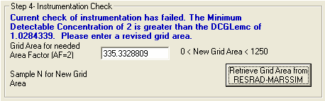
The user can either enter the revised grid area for a DCGLemc that is equal to the MDC, or it can once again be retrieved from the excel file with the Area-Area Factor curve by selecting "Retrieve Grid Area from RESRAD-MARSSIM":
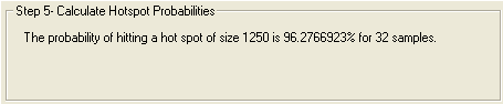
If the user passed the instrument test, then SADA will perform a hot spot probability check to estimate the chances of hitting a hot spot equivalent to the size of the grid area.
If the user failed the instrument test, then SADA will perform a hot spot probability estimate for both the original sample size and the alternative sample size based upon the new (smaller) grid area.
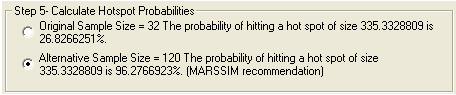
The user can select either the original sample size, or the alternative sample size, but MARSSIM recommends use of the alternative sample size.
Once these parameters are complete and a sample size has been determined, SADA will then generate a grid design for Class I and II sites. When generating a grid design, SADA uses its simple grid mechanism. This approach chooses a random starting point in the survey unit. This starting point serves as an anchor for the design. Samples are then distributed according to the recommended separation distance D = (Survey Area)/(Number Of Samples).
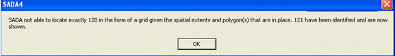
Often this recommended separation is unsuitable to adequately fill the survey area. SADA then iteratively contracts or expands the distance between sample points until a grid design is arrived at that 1) completely fills the survey unit and 2) comes as close as possible to the number of samples required. The number of samples will always be at least as large as the number required. However due to grid specifications and survey unit geometries more samples may be required to fill the area.
The user can then view the sample design.
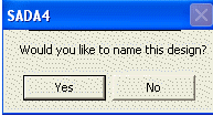
If the generated design is acceptable, name the design and SADA will lock it permanently. When SADA locks a design it freezes all parameters including MARSSIM parameters, site boundaries, survey units, and generated sample designs.
The user should enter a name for the locked design to save it.
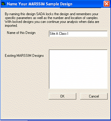
The user can see these locked values by selecting the MARSSIM name from the MARSSIM parameters step.